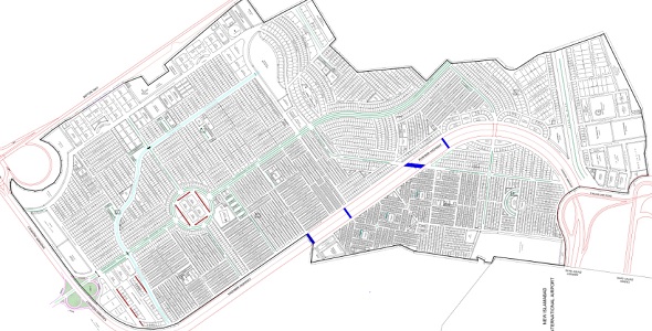
Top City-1 Housing Scheme Islamabad had issued a provisional revised and extended layout plan map, that is submitted to RDA for approval. There is no confirmation whether this extended map is approved or not, but the new plots issued by Top City-1 in D-extension and other blocks are marked in this new map.
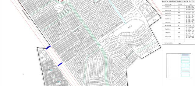
The revised map is extended over an area of 10500 Kanals of land approximately which includes residential, commercial, amenities, roads, graveyard as well as airport link roads area. Total number of residential plots shown in the map are 7437, while 33 plots are reserved for apartment buildings.
The revised map shows Block A, B, C, D, E, F, G, H, I, J and K. The residential blocks span from A up to J, while K is the commercial block located right next to C block and facing the motorway.
This provisional map should be used for reference only for new plots, and may not be considered as final unless approved by the civic authority.
Following is the high quality jpeg image of the revised map: (click to enlarge)
Following is the high quality map in pdf format: (click to open and download)