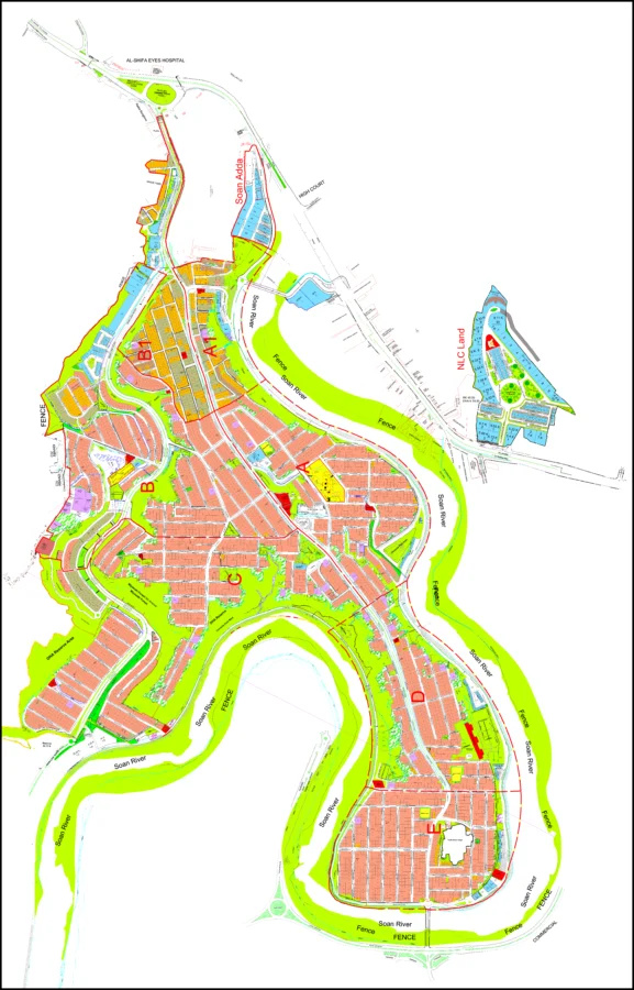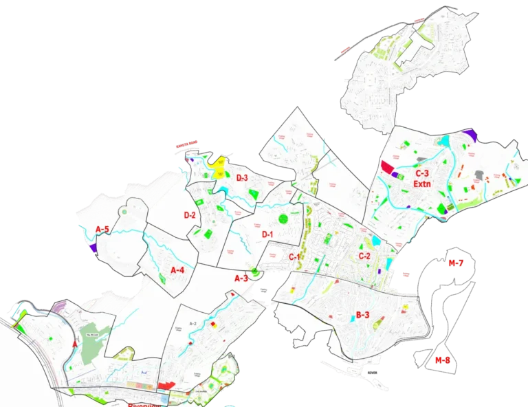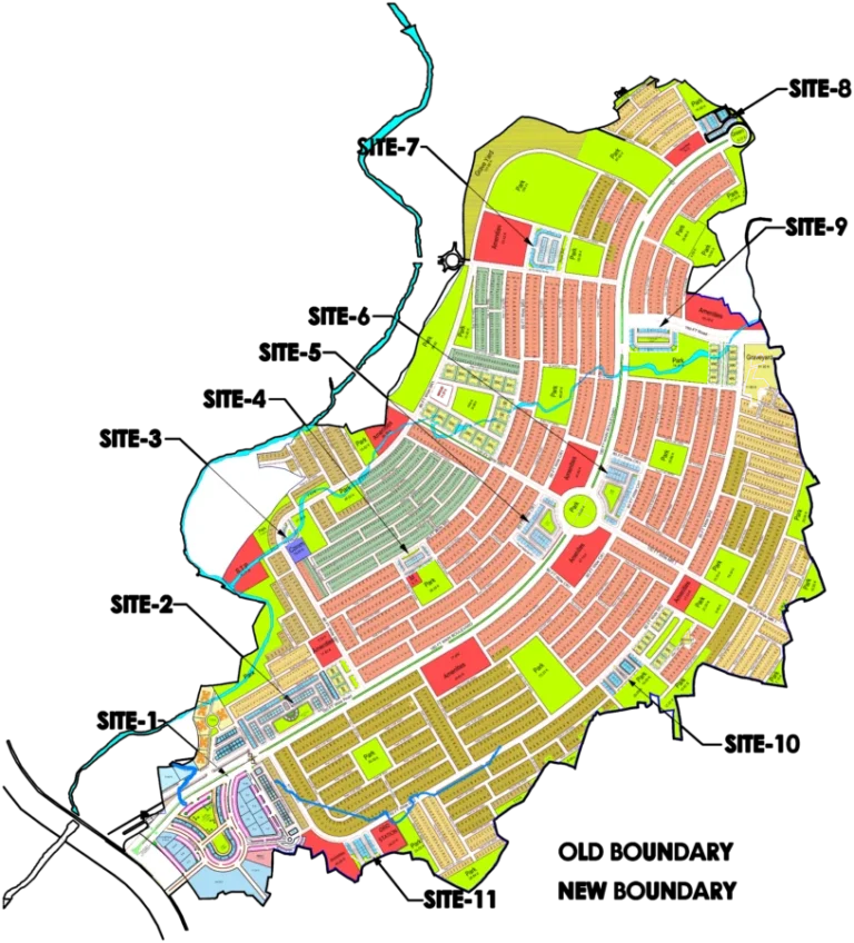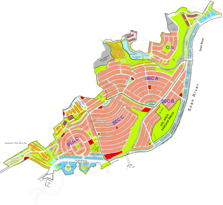
This map provides a comprehensive overview of DHA Phase 2, Islamabad, designed for easy navigation and property identification. Visitors can use this interactive tool to understand the society's layout, locate specific blocks (A-J), and identify key features such as main roads, internal streets, parks, and commercial zones. The map's clear segmentation and visible landmarks offer a practical guide for residents, prospective buyers, and investors to orient themselves within this well-established and developed housing phase.
DHA Phase 2 Islamabad Map
Explore DHA Phase 2 Islamabad with this detailed interactive map, highlighting sectors, roads, and amenities.
Loading map controls…
Location and Access
- Main access: Main GT Road, Islamaba Expressway
- Nearest interchange / major junction: T-Chowk
- Direct access from Islamabad Expressway
- Direct access from Main G.T. Road
- Multiple secured entry and exit gates
- Connected via Tipu Boulevard, Sir Syed Boulevard, and Plaza Avenue
- Iqbal Boulevard and Jinnah Boulevard provide access from G.T. Road
- Proximity to Rawalpindi and Islamabad city centers
What Is Shown on the Society Map
- Clearly demarcated sectors labeled A through J
- Extensive network of main roads and internal streets
- Designated commercial zones within various blocks
- Central park area with recreational facilities
- Family Bee Park marked
- Graveyard area visible
- Large open green spaces and water channels
- Prominent roundabouts and circular roads
- View the calibrated society plan over the Google satellite map.
- Zoom in to understand roads, blocks, plot numbering and surrounding access.
- Use GPS to check your current position while visiting the society.
- Open available property and project pins for their basic details.
Available Property Types and Sizes
- 5 Marla
- 10 Marla
- 1 Kanal
- 2.5 Marla (Commercial)
- 4 Marla (Commercial)
- 5.33 Marla (Commercial)
- 8 Marla (Commercial)
Within 10 km
Important Nearby Landmarks
Approximate straight-line distance from the map centre. Only established, recognisable landmarks are shown.
Giga MallShopping Landmark
ZETA Mall IslamabadShopping Landmark
Institute of Space Technology (IST)University
Amazon MallShopping Landmark
Sami silk centerShopping Landmark
Foundation University Rawalpindi CampusUniversity
IBADAT International UniversityUniversity
Map-linked inventory
12 active listingsProperties Available on This Map

Residential Property
Strategic Corner Value: Sector H, DHA Phase 2 Islamabad Corner 1 Kanal Plot for Sale
1 kanal · Plot 37 · Street 04Rs 48,000,000
Residential Property
Elite Choice Corner: Corner 1 Kanal Plot for Sale in Sector G, DHA Phase 2 Islamabad
1 kanal · Plot 11 · Street 12Rs 69,500,000
Residential Property
Top Tier Sector F Corner: 1 Kanal Plot Up for Sale in Sector F, DHA Phase 2 Islamabad
1 kanal · Plot 01 · Street 04Rs 69,500,000
Residential Property
Main Sector Road Corner: Sector B, DHA Phase 2 Islamabad Corner 1 Kanal Plot for Sale
1 kanal · Plot 27Rs 52,000,000
Residential Property
Prime 1-Bed Corner Apartment for Sale – Block 14, Defence Residency, DHA 2 Islamabad
602 sqftRs 7,500,000
Residential Property
Executive 2-Bed Corner Apartment with Margalla Views – Defence Executive Tower, DHA 2
1523 sqftRs 16,000,000
Commercial Property
Gate 4 Entrance: 4 Marla Commercial Available for Sale in DHA Phase 2 Islamabad
4 marla · Plot 32Rs 43,000,000
Commercial Property
Entry Level Commercial: Sector H, DHA Phase 2 Islamabad 5 Marla Commercial for Sale
5 marla · Plot 96Rs 35,000,000
Commercial Property
Premium Back-row: 5 Marla Commercial for Sale in Sector E, DHA Phase 2 Islamabad
5 marla · Plot 61Rs 110,000,000
Commercial Property
Near Askari Tower 2: 4 Marla Commercial Available in Sector D, DHA Phase 2 Islamabad
4 marla · Plot 24Rs 40,000,000
Commercial Property
Secondary Frontage: 4 Marla Commercial Available in Sector D, DHA Phase 2 Islamabad
4 marla · Plot 112Rs 40,000,000
Commercial Property
Value Commercial: 4 Marla Commercial for Sale in Sector D, DHA Phase 2 Islamabad
4 marla · Plot 92Rs 46,500,000